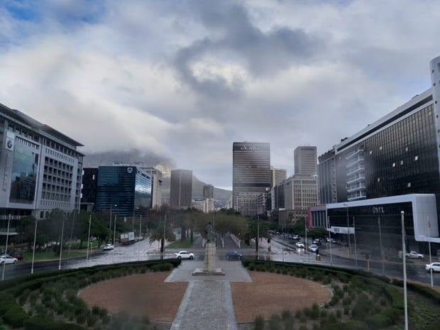


Rain and overcast weather.
Parts of the Western Cape should be on the lookout as severe thunderstorms are expected in places, and will lead to localised flooding, according to the South African Weather Service.
Warnings:
– Extremely high fire danger conditions are expected over the eastern areas of the Northern Cape, the eastern half of the Western Cape, the western parts of the Eastern Cape and the North West.
– Gale to strong gale force north-easterly winds (65-80 km/h) are expected along the coast between Port Elizabeth and Durban as well as north-westerly winds (65-80 km/h) between Cape Point and Cape Agulhas.
Watches:
– Severe thunderstorms leading to localised flooding is expected over the Cape Metropole, Overberg, south-western parts of the Cape Winelands and southern West Coast District.
Special weather advisories:
– A cut off low is expected to affect the Western Cape and Northern Cape provinces on Wednesday. The public and small stock farmers are advised that very cold conditions and very rough seas can be expected.
– Strong winds (50-62 km/h) are expected over the interior of the Western Cape and the southern interior of the Northern Cape on Wednesday afternoon.
The weather in your province:
Gauteng will be cloudy and cool with isolated showers and thundershowers in the south.
The expected UVB sunburn index is low.
There will be morning fog patches and drizzle along the escarpment in Mpumalanga, with isolated showers and rain in the south west, otherwise partly cloudy and cold, but cool in the Lowveld.
Limpopo can expect morning fog patches and drizzle along the escarpment, otherwise partly cloudy and cold to cool.
The North West will be partly cloudy, windy and cool with scattered showers and thundershowers, but isolated in the east.
In the Free State, it will be partly cloudy, windy and cool with scattered showers and thundershowers.
The Northern Cape will be partly cloudy, windy and cold to cool with isolated showers and thundershowers in the east and southern high ground.
The wind along the coast will be moderate to fresh north-westerly reaching strong at times, becoming light to moderate north of Lambert’s Bay from the afternoon.
The Western Cape will be cloudy, windy and cold to cool with isolated to scattered showers and thundershowers, but widespread along the south-west coast into the adjacent interior where localised flooding is expected.
The wind along the coast will be strong to gale north-westerly, reaching strong gale conditions south of Cape Point at times.
The expected UVB sunburn index is moderate.
The western half of the Eastern Cape will be partly cloudy, windy and cool with isolated showers, but scattered in the north.
The wind along the coast will be strong north-easterly, becoming moderate westerly from the afternoon.
The eastern half of the Eastern Cape will be partly cloudy and cool with isolated showers, but scattered in the extreme north.
The wind along the coast will be fresh to strong north-easterly, moderating from the late afternoon.
KwaZulu-Natal can expect morning fog over the interior, otherwise partly cloudy to cloudy and cool with isolated showers and thundershowers.
The wind along the coast will be fresh to strong north-easterly, but gale conditions south of Durban.
The expected UVB sunburn index is moderate.
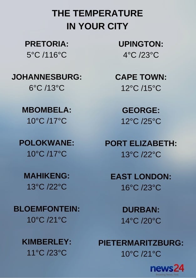


The forecast for 2 September.
– Compiled by Kamva Somdyala
Click here to see the specific forecast for your city over the next few days.

